 4:14
4:14 The challenge
- →Decades-old wells buried 4–20 ft under regraded ground across the field.
- →Historical surveys unreliable, wells found up to ~60 ft from surveyed positions.
- →Early-1900s cut-and-pulled casings; surface access lost to earthworks and landslides.
- →Heavy magnetic clutter, pipelines, fences, pumping units and casing reused as slope shoring.
Our solution
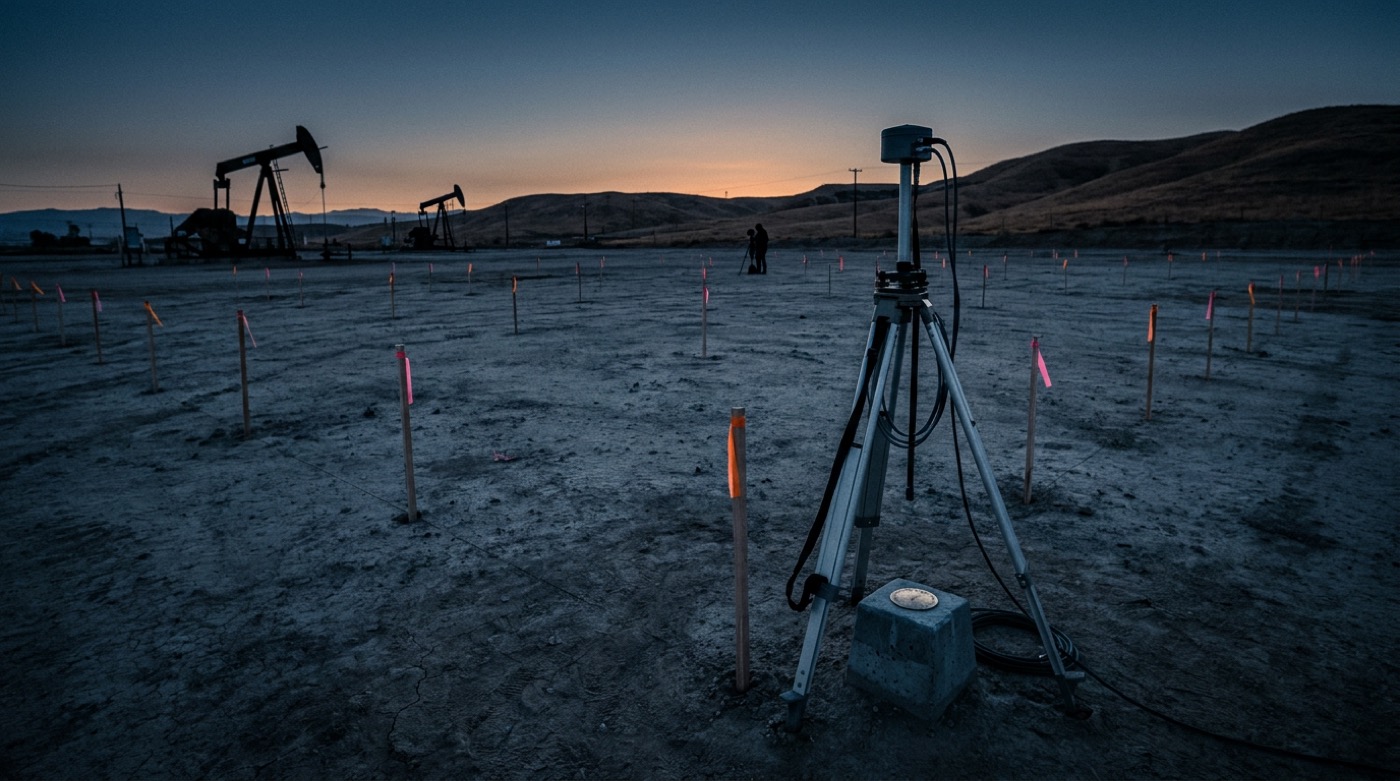
Near-Surface Wellbore Detection (NSWD): a 100×100 ft surface lattice (a survey point every 10 ft) capturing high-density vector-magnetometer data referenced to a theodolite-tied monument. Vertical and transverse field components are modeled in 3D to pinpoint buried casing before excavation.
Buried casing pinpointed from surface, excavate with confidence
The result
±10 ft
to target, vs. up to ~60 ft historical survey error
- ·Deployed a 100×100 ft magnetometer lattice over each suspected well location
- ·Resolved vertical & transverse field anomalies in 3D to flag buried casing
- ·Separated true casing signatures from pipeline / surface-clutter interference
- ·Surface-located targets staked for excavation, no blind digging
Ranging
AMR + PMR
Deployment
Wireline
Re-entry
Yes
Location
Southern California, USA
Year
2024 – ongoing
Watch, related footage
Full video library → 4:14  7:02
7:02 Intersecting Two Abandoned Wells Under Los Angeles (Part 1) | P&A Case Study
 4:22
4:22